Destination: Flügenspitz Süd, Amden (1703 m) – Starting point: Parkplatz Leistkammstrasse (1273 m)- Elevation: est 513 m – Distance: est. 7.7 km – Duration: est. 5.5 hours
Weather was excellent on Sunday. Sunshine! It does feel like Mother Nature skipped Spring and went straight to summer. We wanted to hike up to Leistkamm 2101 meter with beautiful view of Walensee. Sadly, we had to make a detour because the way up to Leistkamm was still covered in snow. Hiking in snow especially on a tough trail can be very tiring and nonetheless, dangerous. At that point, we decided to detour and head to Flügenspitz which was only 10 minutes from where we were.
The day before, Herr Hallo & I were preparing our gadgets to track the hike. Herr Hallo has a Garmin Forerunner 410 which he abandoned in our “Elektro” box and we decided to use it for the hike alongside the Geo Tracker app I have on my phone. During the hike, we compared data and seemingly the Garmin watch is far more accurate that the Geo Tracker app. Also, I did a mistake by pausing the app during breaks and forgot to record when we were on the move again. At the end of the hike, I have inaccurate and missing data from my app. The GPS data on this post is from Garmin watch.
You could view our Strava stats here.
HIKING REPORT
We started our journey at 08:00 and we headed to Glarnerland, our usual breakfast place. I am really happy about this hike because we’ve been hibernating for too long throughout winter. The drive away from Glarnerland is always beautiful especially in the morning (click!). Mountains on both side of the highways with morning sunlight shining on the mighty mountains. The scenery looked so blinding and mystical. The drive towards Amden was winding but the view was sensational. Sometimes I don’t know where to look and wish that I have 4 sets of eyes. One set each on the left, right, back and front so I won’t miss anything.

Erika is her name.
We reached the car park on Leistkammstrasse around 09:30. The car park was situated in a village at the foot of the mountains so the villagers have mountain view on front/backyard.
The way from the village towards the hiking trail is a downward slope which can be “deceiving”. It’s easy breezy in the start when you are going towards the trail but don’t forget when you are heading down from the mountains all tired and weak, you have to walk up this very slope to get to the car. Your feet would feel 10x heavier if you physically condition is unfit like mine.
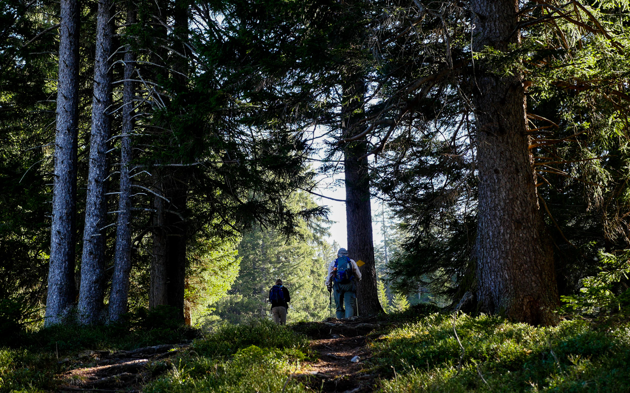
The beginning of the hike is quite nice. We were hiking through the forest which is my favourite part of nature. I love everything in the forest. The smell, the trees, the small living organism on the ground, the sunlight shining through the trees etc. In Japan, there is a practice called shinrin-yoku (森林浴) which means forest bathing. It is a form of therapy and wellness by taking a trip and engaging with nature. Being in the nature contributes positive psychology benefits. Studies show that forest bathing helps combat depression and stress. You could read more about shinrin-yoku here. Lately, I saw a video on Youtube about travel to a secluded restaurant in Kyoto’s bamboo forest. I found captivating particularly what the owner of the restaurant said about the spirit of the forest. You could watch it here.
At the end of the forest, we took a short break. Looking over the mountains, taking shade under the trees and listening to birds chirping. I recorded and audio. Turn on your speaker and click PLAY.

Switzerland.
Nature at it’s best. Don’t forget to look back once in awhile during your hike.

Hiking trail marker.
Coat of Arm belongs to St. Gallen.
We continue our journey after the forest on a tar road leading up to Alp Looch restaurant. One could drive from the village to Alp Looch. From that point onward, you’ll have to go on foot (or with Mountain bike) up to the mountains. Before we reached Alp Looch, we passed a farm house and a farmer were working on the field (pictured). Herr Hallo Snr. was talking to the farmer and he told us they had snow just two weeks ago. That make sense because there were still patches of snow on our way up.
From Alp Looch, we carried on our journey towards Leistkamm. We entered the forest again and found a spot to have a short break after 1.5 hours of trekking. We had some salami, bread, oranges and apples we brought with us. You could check out our “pause” spot here.
Our lunch spot was not far from a little natural waterfall.
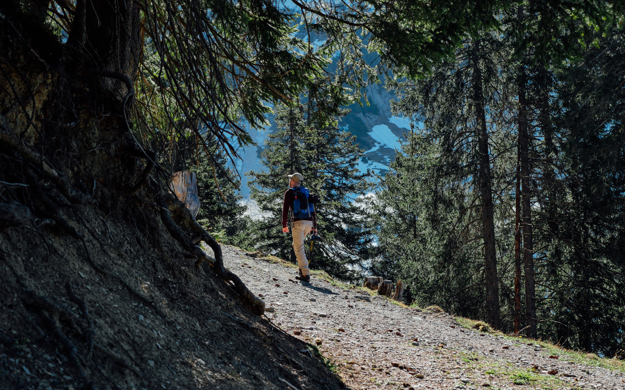
After our break, we were ready to go up to Leistkamm untill we reached the “intersection” to Leistkamm and Flügenspitz. The hiking trail up to Leistkamm was still covered in thick snow. The way up there is quite steep (apparently) and going up when the trail is covered in snow can be challenging and dangerous. I can testify that after our experience hiking in the snow at Obersee last year.We unanimously agree to make a detour to Flügenspitz which is 10 minutes from where we were. We will come back for Leistkamm in a few months when the trail is clear of snow.

Imagine waking up to this view everyday.
See: Farmer at work.
The way to Flügenspitz is easy and also scary because there was a snow covered short path. I was stuck in the snow because I didn’t know where to step. I was scared that I will slip and fall down the slope so I made sure I make my way across this snow patch as careful as possible.
We heard sounds from Leistkamm. We saw four person trying to descent from Leisstkamm. It must be slippery and really difficult to descent. They were shrieking and squealing. I hope they made it down safe and sound.
On Flügenspitz, the wind was relatively strong and was not a good place for lunch. We stayed only a short time before we headed down in search for a good lunch spot to grill our sausages. We started grilling our cervelats (Swiss National Sausage) as soon as we setup a fireplace. Firewood were easy to find and our fire started quickly. Once we filled our stomachs, we put up the fire with snow. Please put out the fire before you leave your fireplace in the woods. We don’t want to start a forest fire, right? It is ILLEGAL to start a fire in some states/Kanton. See this link for more information about the current situation.
We made our way down at around 13:41. On the way down, we saw a dog charging at us. The dog was carrying a pine cone in his mouth. He puts the pine cone down as soon as he reached us because he wanted to play catch. We played a few times with him and he could not get enough of it. His owners then came and instructed him to stop disturbing us. Initially he didn’t want to, but he is a good dog and followed orders. So cute!
We reached the car around 15:00 and grabbed an ice cream on the highway before we head home.
Till then.
x Frau Hallo
[adinserter block=”2″]

Father & Son.

Snow covered trail up to Leistkamm.

The view on the opposite.

Hiking trail markers.
Blue: Very tough.
Yellow with red & white stripe: Tough
Yellow: Easy

Almost there – Flügenspitz!

Flügenspitz, 1703m.

Panoramic view.

Heading down to search for lunch spot.

Nature coat hanger.

We had break under this tree.

Let us know your thoughts!