HIKING
BACHTEL, ZÜRCHER-OBERLAND
26TH MARCH, 2017.
Destination: Bachtel-Kulm 1115m – Starting point: TCS Parkplatz Girenbad – Elevation: est 316m – Distance: est. 4.94 km – Duration: est. 2.13 hours (excl. 2 hours lunch).

Data from Geo Tracker Android App
Quite happy with this free app from https://geo-tracker.org/
26TH MARCH, 2017. Destination: Bachtel-Kulm 1115m – Starting point: TCS Parkplatz Girenbad – Elevation: est 316m – Distance: est. 4.94 km – Duration: est. 2.13 hours (excl. 2 hours lunch).
So, this is our first mini hike for 2017. The weather was not that great. Low visibility, cold and windy but we have to go out! We have been sitting on our bums all through winter and there shouldn’t be anymore excuse to stay at home. I am really glad that Spring is approaching and the days are longer. Nothing beats the feeling of leaving the office and see the sun still up. Ultimately, I am excited to test out the new Geo Tracker app I found so that I could make our blog more interactive.
WHAT’S NEW ON THE BLOG?
I downloaded and tested a free app called Geo Tracker. Basically, the app acts as a GPS tracker. It tracks location at certain time intervals, time, altitude, speed and so on. For me, this is a great app as we could review our hikes after it ended. What you will see on this blog post and the future ones are as follows.
1. HIKING GRAPH
From the graph, you could see where we were at what altitude and the duration of time we took to complete the hike.
2. INTERACTIVE MAP
There is a map at the end of the blog post which shows the route we took. This route is generated from the data captured by Geo Tracker app. The Map is also interactive. You could see where the photos were taken.
Note: In order to view the photos, you have to expand the map > View Larger Map (icon on top right of the Map)
Bachtel is located near Hinwil in Kanton Zürich and it is quite near to where we live. It’s less than 30 minutes drive from our place so we started our journey by car at around 08:00. Herr Hallos Snr. picked us up and we headed for breakfast in Steiner-Beck Grüningen which is on the way. By the time we reached our starting point, it was est. 09:30.
We parked our car at TCS Parkplatz Girenbad and started from there. We walked up Eggstrasse (refer to Map below) passing through a small village. The village lies on the small hill overlooking Lake Zurich and is very near to the woods. The weather was not that great so the view was rather foggy but we still could see Lake Zürich, Greifensee and Pfäffikersee. Yup, we have a lot of lakes in Switzerland. Several thousands according to Google.
When we started, we saw two person on the route but they were heading downhill. There were several mountain bikers cycling up the small hill towards Bachtel. Apparently this route is popular for mountain bikers (MTB). There are several marked chicken line. I found out that chicken line is easy route for mountain bikes. But why is it called chicken line remains a mystery. Herr Hallo has an interesting interpretation. He said that it is called chicken line because the MTBs make chicken-like sound effect during braking. Err? Is that so? Anybody could enlighten me?

Fellow hikers.
Gloomy day & low visibility.

Sprouting wild flowers.
About half hour walking through the village, we entered the woods. In the woods, the flower beds are taking over the forest ground. Flowers are blooming and birds are chirping. A sign that Spring is here to stay.
We followed along Unterer Hochhopfweg until we came to an intersection. We followed the trail ahead to a spot with tall beautiful trees and little path for walking. I love being in the middle of places like this. I love seeing how little we are in the center of this universe. The way up from there was a little steep but totally manageable. We took small rest in between the hike. As you can see from the data, we took about 30 minutes rest for our 2.13 hours hike.
It took us about 1.16 hours to reach the Bachtel. Rumor has it that the view from Bachtel is stunning during clear days. We were unlucky yesterday. We couldn’t see much. There is a 60 meter radio tower which is accessible with stairs on top of Bachtel. I didn’t go up there due to the weather. Instead, we spent 2 hours making fire and grilling sausages on the peak. Standing by the fire during windy and cold days outdoor is so nice.

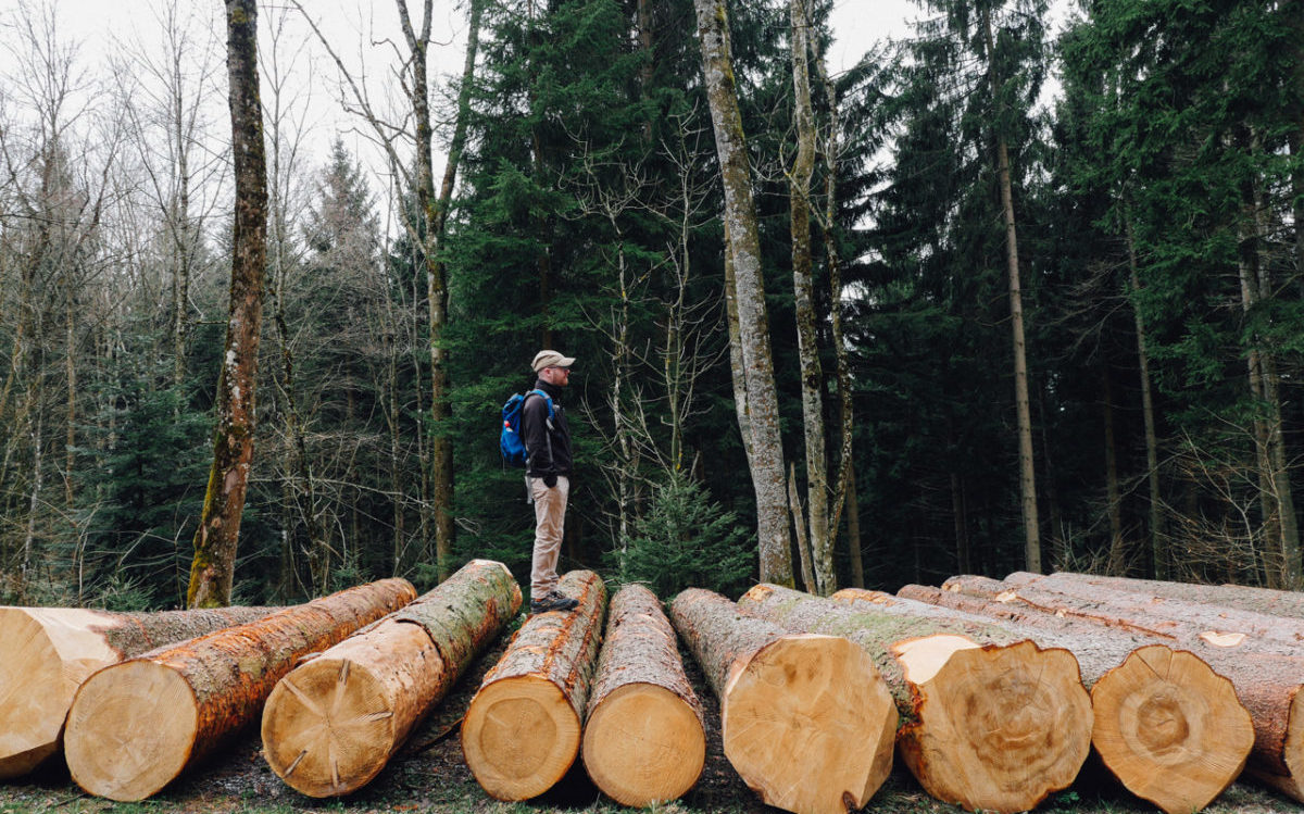
Tall trees, little people.
After we had our sausages, bread, chocolates and drinks, we headed to Restaurant Bachtel Kulm. The restaurant was nice. Spacious, bright and clean. We ordered only drinks there but the food looks good. Bachtel is also accessible by car. You could drive straight to the restaurant which has panoramic view of the Swiss Alps. We will probably drive up there during good days to enjoy the view and try the food in the restaurant.
After our coffees, milk and hot chocolates, we headed down the same way we came. We reached our car around 13:30 making the hike merely 2.13 hours and 4.94 kilometers (two ways). Even though it wasn’t a tough hike, Herr Hallo and I were so tired we spent the evening taking naps and only had dinner at 20:00. End of report.
Do play with the interactive map below. The map is open to public and if you want to visit Bachtel via the same route, you could print it out or save it on your phone.
We’d love to hear what you think of the new interactive map & graph on this post. Any ideas/suggestions/comments are welcome!
Till next post!
x Frau Hallo

Mother Nature & I.

Little People

Life vs. Death

Umbrellas.

Herr Hallo Snr.

Stairs.
I hate stairs.

Herr Hallo & Bachtel Turm
Bachtel Tower is a 60m tall radio tower. Visitors could use the stairs and scale the tower. There is a panoramic platform on the top.

View from top of Bachtel 1115m
Rumour has it that the view is spectacular on clear days.
Let us know your thoughts!